<Back to Index>
- The Netherlands Port of Rotterdam, 11.2M TEUs
PAGE SPONSOR
The Port of Rotterdam is the largest port in Europe, located in the city of Rotterdam, Netherlands. From 1962 until 2004 it was the world's busiest port, now overtaken by first Shanghai and then Singapore. In 2009, Rotterdam was the world's tenth largest container port in terms of twenty - foot equivalent units (TEU) handled (2008: ninth, 2006: sixth).
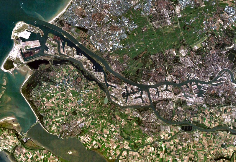
Covering 105 square kilometers (41 sq mi), the port of Rotterdam now stretches over a distance of 40 kilometers (25 mi). It consists of the city center's historic harbor area, including Delfshaven; the Maashaven / Rijnhaven / Feijenoord complex; the harbours around Nieuw - Mathenesse; Waalhaven; Vondelingenplaat; Eemhaven; Botlek; Europoort, situated along the Calandkanaal, Nieuwe Waterweg and Scheur (the latter two being continuations of the Nieuwe Maas); and the reclaimed Maasvlakte area, which projects into the North Sea.
The port of Rotterdam has a long history, stretching back into the 14th century. As the city of Rotterdam has developed from a small town into a major harbor city, the port has expanded. In earlier centuries, docks were built on the banks of the Nieuwe Maas river. In the 19th century, connections between Rotterdam and the North Sea were poor, with a large estuary / delta area with many small waterways between them. Ships had to sail around the island of Voorne - Putten to go out to sea. This could take several days or even weeks.
In the first half of the twentieth century the port activities moved from the center westward towards the North Sea. To improve the connection to the North Sea, the Nieuwe Waterweg ("New Waterway"), a large canal, was designed to connect the Rhine and Meuse rivers to the sea. The Nieuwe Waterweg
was designed to be partly dug, then to further deepen the canal bed by
the natural flow of the water. Ultimately however, the last part had to
be dug also. Nevertheless, Rotterdam from now on had a direct connection
between the sea and harbor areas with sufficient depth. The Nieuwe Waterweg has since been deepened several times. The Nieuwe Waterweg was ready in 1872 and all sorts of industrial activity formed on the banks of this canal.
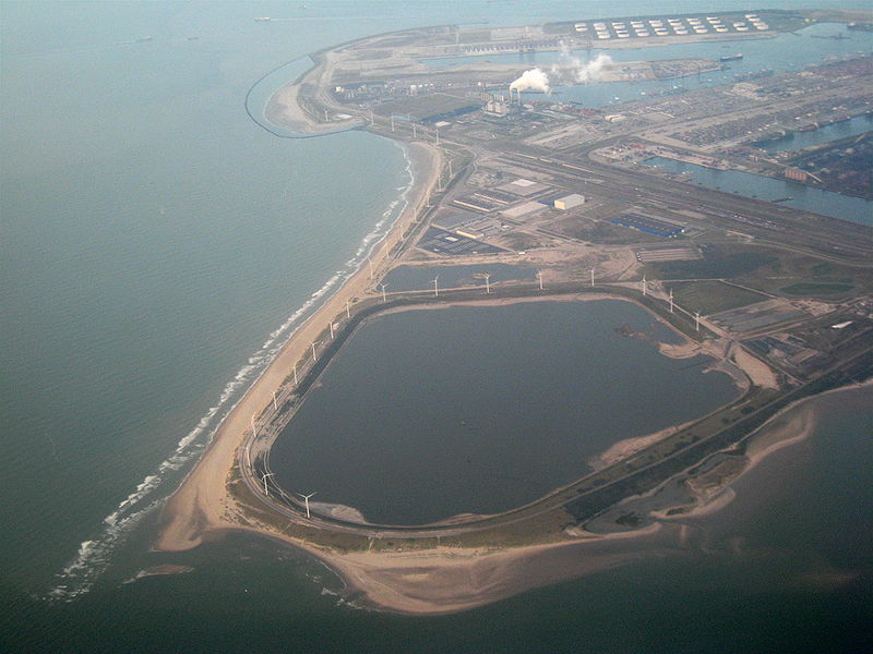
Over the years the port was further developed seaward by building new docks and harbor - basins. Rotterdam's harbor territory has been enlarged by the construction of the Europoort (gate to Europe) complex along the mouth of the Nieuwe Waterweg. In the 1970s the port was extended into the sea at the south side of the mouth of the Nieuwe Waterweg by completion of the Maasvlakte (Meuse - plain) which was built in the North Sea near Hoek van Holland.
In the past five years the industrialized skyline has been changed by the addition of large numbers of wind turbines taking advantage of the exposed coastal conditions. The construction of a second Maasvlakte received initial political approval in 2004, but was stopped by the Raad van State (the Dutch Council of State, which advises the government and parliament on legislation and governance) in 2005, because the plans did not take enough account of environmental issues. On October 10, 2006, however, approval was acquired to start construction in 2008, aiming for the first ship to anchor in 2013.
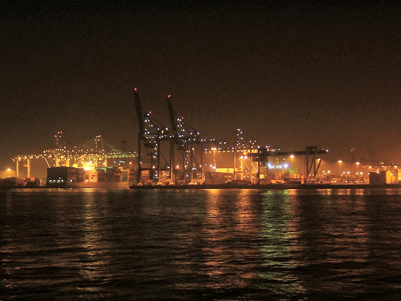
Most important for the port of Rotterdam are the petrochemical industry and general cargo transshipment handling. The harbor functions as an important transit point for transport of bulk and other goods between the European continent and other parts of the world. From Rotterdam goods are transported by ship, river barge, train or road. Since 2000 the Betuweroute, a fast cargo railway from Rotterdam to Germany, has been under construction. The Dutch part of this railway has been opened in 2007. Large oil refineries are located west of the city. The river Meuse and Rhine also provide excellent access to the hinterland.
The EECV quay of the port has a draft of 24 meters (78 feet), making it, along with Terminal Marítimo de Ponta da Madeira in Brazil, one of only two available mooring locations for the largest bulk cargo ship in the world, the iron ore bulk carrier Berge Stahl when it is fully loaded. The ship's draft of 23 meters (75 feet) leaves only 1 meter (3 feet) of under keel clearance, therefore it can only dock in a restricted tidal window.
Much of the container loading and stacking in the port is handled by autonomous robotic cranes and computer controlled chariots. The ECT pioneered the development of terminal automation. At the Delta terminal, the chariots --or automated guided vehicles (AGV) -- are unmanned and each carry one container. The chariots navigate their own way around the terminal with the help of a magnetic grid built into the terminal tarmac. Once a container is loaded onto an AGV, it is identified by infrared 'eyes' and delivered to its designated place within the terminal.
Unmanned Automated Stacking Cranes (ASC) take containers to / from the AGV's and store them in the stacking yard. The newer Euromax terminal implements an evolution of this design that eliminates the use of Straddle Carriers for the land - side operations.
The port is operated by the Port of Rotterdam Authority, originally a municipal body of the municipality of Rotterdam, but since 1 January 2004, a government corporation jointly owned by the municipality of Rotterdam and the Dutch State.
The port of Rotterdam and its surrounding area is susceptible to
a storm surge from the North Sea. In the Delta Works flood protection
plan various options have been considered for protecting Rotterdam.
Finally a unique design was built, the Maeslantkering. This flood
barrier consists of two huge doors that normally rest in a dry dock besides the Nieuwe Waterweg. When a flood of 3 meters (9.8 ft) above NAP (mean sealevel) is predicted the gates are floated into positions, like caissons,
and sunk in place. When the waterlevel recedes enough to open the gates
are floated back into their docks. Another barrier, the hartelkering is situated in the Hartelkanaal.