<Back to Index>
- Physiologist Emil du Bois - Reymond, 1818
- Writer Fritz Reuter, 1810
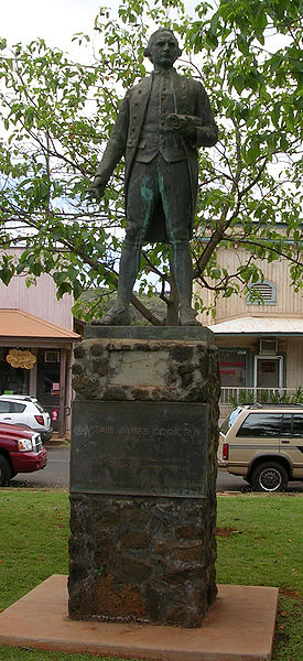
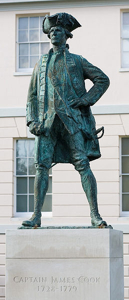
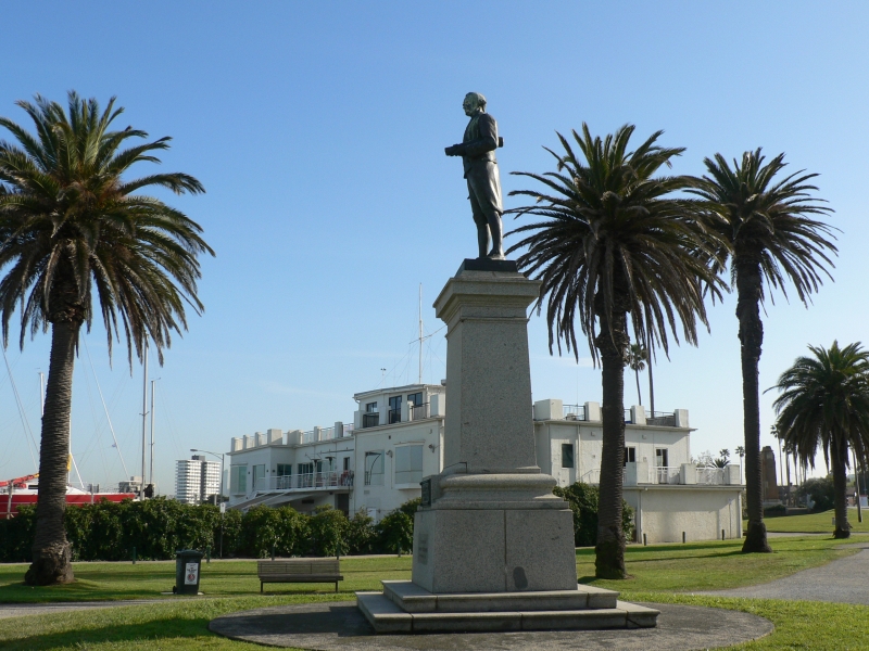
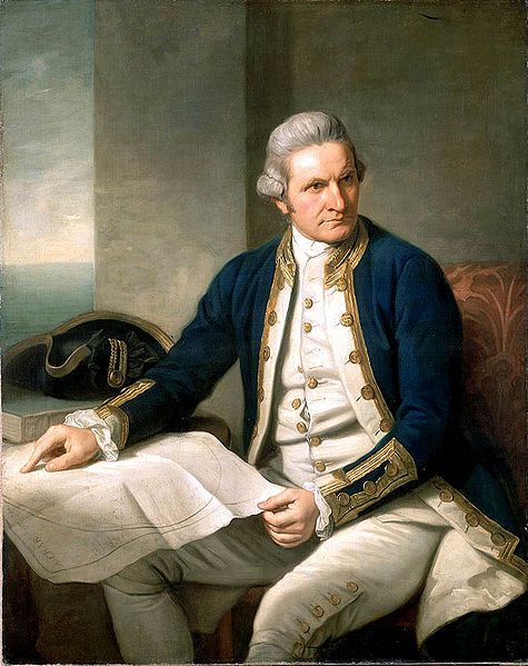
- Captain of the Royal Navy and Explorer James Cook, 1728
PAGE SPONSOR
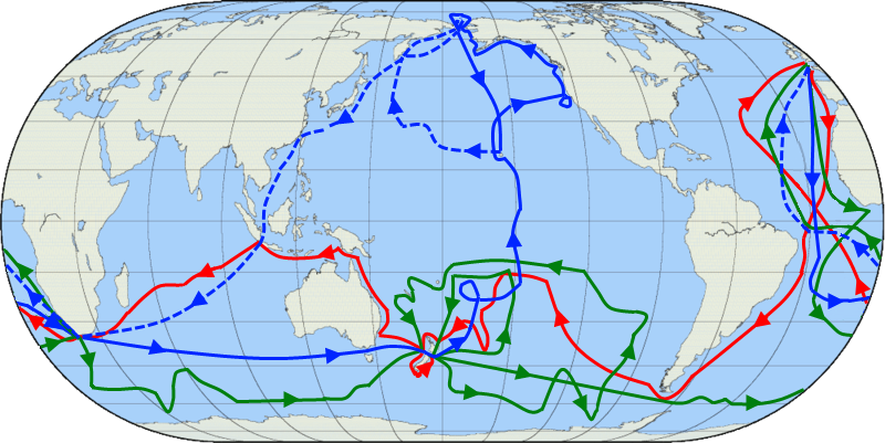
Captain James Cook FRS RN (7 November 1728 – 14 February 1779) was a British explorer, navigator and cartographer, ultimately rising to the rank of Captain in the Royal Navy. Cook made detailed maps of Newfoundland prior to making three voyages to the Pacific Ocean during which he achieved the first European contact with the eastern coastline of Australia and the Hawaiian Islands as well as the first recorded circumnavigation of New Zealand.
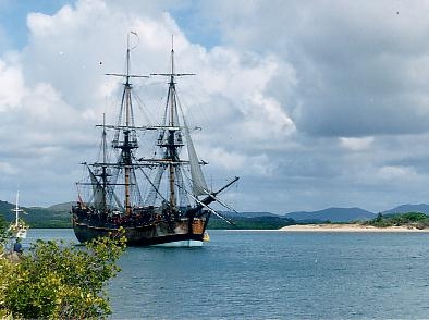
Cook joined the British merchant navy as a teenager and joined the Royal Navy in 1755. He saw action in the Seven Years' War, and subsequently surveyed and mapped much of the entrance to the Saint Lawrence River during the siege of Quebec. This helped bring Cook to the attention of the Admiralty and Royal Society. This notice came at a crucial moment both in his personal career and in the direction of British overseas exploration, and led to his commission in 1766 as commander of HM Bark Endeavour for the first of three Pacific voyages. Cook charted many areas and recorded several islands and coastlines on European maps for the first time. His achievements can be attributed to a combination of seamanship, superior surveying and cartographic skills, courage in exploring dangerous locations to confirm the facts (for example dipping into the Antarctic Circle repeatedly and exploring around the Great Barrier Reef), an ability to lead men in adverse conditions, and boldness both with regard to the extent of his explorations and his willingness to exceed the instructions given to him by the Admiralty. Cook was killed in Hawaii in a fight with Hawaiians during his third exploratory voyage in the Pacific in 1779.
Cook was born in the village of Marton in Yorkshire, now a suburb of Middlesbrough. He was baptised in the local church of St. Cuthbert, where his name can be seen in the church register. Cook was the second of eight children of James Cook, a Scottish farm labourer, and his locally born wife, Grace Pace, from Thornaby - on - Tees. In 1736, his family moved to Airey Holme farm at Great Ayton, where his father's employer, Thomas Skottowe paid for him to attend the local school (now a museum). In 1741, after five years schooling, he began work for his father, who had by now been promoted to farm manager. For leisure, he would climb a nearby hill, Roseberry Topping, enjoying the opportunity for solitude. Cooks' Cottage, his parents' last home, which he is likely to have visited, is now in Melbourne, having been moved from England and reassembled, brick by brick, in 1934.
In 1745, when he was 16, Cook moved 20 miles (32 km) to the fishing village of Staithes, to be apprenticed as a shop boy to grocer and haberdasher William Sanderson. Historians have speculated that this is where Cook first felt the lure of the sea while gazing out of the shop window.
After 18 months, not proving suitable for shop work, Cook travelled to the nearby port town of Whitby, to be introduced to friends of Sanderson's, John and Henry Walker. The Walkers were prominent local ship owners and Quakers, and were in the coal trade. Their house is now the Captain Cook Memorial Museum. Cook was taken on as a merchant navy apprentice in their small fleet of vessels, plying coal along the English coast. His first assignment was aboard the collier Freelove, and he spent several years on this and various other coasters, sailing between the Tyne and London. As part of this apprenticeship, Cook applied himself to the study of algebra, geometry, trigonometry, navigation and astronomy, all skills he would need one day to command his own ship.
His three year apprenticeship completed, Cook began working on trading ships in the Baltic Sea. He soon progressed through the merchant navy ranks, starting with his 1752 promotion to Mate (officer in charge of navigation) aboard the collier brig Friendship. In 1755, within a month of being offered command of this vessel, he volunteered for service in the Royal Navy, as Britain was re-arming for what was to become the Seven Years' War. Despite the need to start back at the bottom of the naval hierarchy, Cook realised his career would advance more quickly in military service and entered the Navy at Wapping on 7 June 1755.
Cook married Elizabeth Batts (1742 – 1835), the daughter of Samuel Batts,
keeper of the Bell Inn, Wapping and one of his mentors, on 21 December 1762 at St. Margaret's Church in Barking,
Essex. The couple had six children: James (1763 – 94), Nathaniel
(1764 – 81), Elizabeth (1767 – 71), Joseph (1768 – 68), George (1772 – 72) and
Hugh (1776 – 93). When not at sea, Cook lived in the East End of London. He attended St Paul's Church, Shadwell, where his son James was baptised. Stepney Historical Trust has placed a plaque on Free Trade Wharf in the Highway, Shadwell, to commemorate his life in the East End of London.
Cook's first posting was with HMS Eagle, sailing with the rank of master's mate. In October and November 1755 he took part in Eagles capture of one French warship and the sinking of another, following which he was promoted to boatswain in addition to his other duties. His first temporary command was in March 1756 when he was briefly the master of the Cruizer, a small cutter attached to the Eagle while on patrol.
In June 1757 Cook passed his master's examinations at Trinity House, Deptford, qualifying him to navigate and handle a ship of the King's fleet. He then joined the frigate HMS Solebay as master under Captain Robert Craig.
During the Seven Years' War, he served in North America as master of Pembroke. In 1758 he took part in the major amphibious assault that captured the Fortress of Louisbourg from the French. Cook then participated in the siege of Quebec City before the Battle of the Plains of Abraham in 1759. He showed a talent for surveying and cartography and was responsible for mapping much of the entrance to the Saint Lawrence River during the siege, allowing General Wolfe to make his famous stealth attack on the Plains of Abraham.
Cook's surveying skills were put to good use in the 1760s, mapping the jagged coast of Newfoundland. Cook surveyed the northwest stretch in 1763 and 1764, the south coast between the Burin Peninsula and Cape Ray in 1765 and 1766, and the west coast in 1767. Cook’s five seasons in Newfoundland produced the first large scale and accurate maps of the island’s coasts; they also gave Cook his mastery of practical surveying, achieved under often adverse conditions, and brought him to the attention of the Admiralty and Royal Society at a crucial moment both in his personal career and in the direction of British overseas discovery. Cook's map would be used into the 20th century, copies of it being referenced by those sailing Newfoundland's waters for 200 years.
Following on from his exertions in Newfoundland, it was at this time that Cook wrote, he intended to go not only:
"... farther than any man has been before me, but as far as I think it is possible for a man to go."
In 1766, the
Royal Society hired Cook to travel to the Pacific Ocean to observe and record the transit of Venus across the Sun. Cook was promoted to Lieutenant and named as commander of the expedition. The expedition sailed from England in 1768, rounded Cape Horn and continued westward across the Pacific to arrive at Tahiti on 13 April 1769, where the observations of the Venus Transit was
made. However, the result of the observations was not as conclusive or
accurate as had been hoped. Cook later mapped the complete New Zealand
coastline, making only some minor errors. He then sailed west, reaching
the south - eastern coast of the Australian continent on 19 April 1770,
and in doing so his expedition became the first recorded Europeans to
have encountered its eastern coastline.
After his departure from Botany Bay he continued northwards, and a mishap occurred when Endeavour ran aground on a shoal of the Great Barrier Reef, on 11 June, and "nursed into a river mouth on 18 June 1770.". The ship was badly damaged and his voyage was delayed almost seven weeks while repairs were carried out on the beach (near the docks of modern Cooktown, at the mouth of the Endeavour River). Once repairs were complete the voyage continued, sailing through Torres Strait and on 22 August he landed on Possession Island, where he claimed the entire coastline he had just explored as British territory. He returned to England via Batavia (modern Jakarta, Indonesia), the Cape of Good Hope and the island of Saint Helena, arriving on 12 July 1771.
Cook's journals were published upon his return, and he became something of a hero among the scientific community. Among the general public, however, the aristocratic botanist Joseph Banks was a bigger hero. Banks even attempted to take command of Cook's second voyage, but removed himself from the voyage before it began, and Johann Reinhold Forster and his son Georg Forster were taken on as scientists for the voyage. Cook's son George was born five days before he left for his second voyage.
Shortly after his return, Cook was promoted to the rank of Commander. Then once again he was commissioned by the Royal Society to search for the mythical Terra Australis. On his first voyage, Cook had demonstrated by circumnavigating New Zealand that it was not attached to a larger landmass to the south; and although by charting almost the entire eastern coastline of Australia he had shown it to be continental in size, the Terra Australis being sought was supposed to lie further to the south. Despite this evidence to the contrary, Dalrymple and others of the Royal Society still believed that this massive southern continent should exist.
Cook commanded HMS Resolution on this voyage, while Tobias Furneaux commanded its companion ship, HMS Adventure. Cook's expedition circumnavigated the globe at a very high southern latitude, becoming one of the first to cross the Antarctic Circle on 17 January 1773. He also surveyed, mapped and took possession for Britain of South Georgia explored by Anthony de la Roché in 1675, discovered and named Clerke Rocks and the South Sandwich Islands ("Sandwich Land"). In the Antarctic fog, Resolution and Adventure became separated. Furneaux made his way to New Zealand, where he lost some of his men during an encounter with Māori, and eventually sailed back to Britain, while Cook continued to explore the Antarctic, reaching 71°10'S on 31 January 1774. Cook almost encountered the mainland of Antarctica,
but turned back north towards Tahiti to resupply his ship. He then
resumed his southward course in a second fruitless attempt to find the
supposed continent. On this leg of the voyage he brought with him a
young Tahitian named Omai, who proved to be somewhat less knowledgeable about the Pacific than Tupaia had been on the first voyage. On his return voyage, in 1774 he landed at the Friendly Islands, Easter Island, Norfolk Island, New Caledonia, and Vanuatu. His reports upon his return home put to rest the popular myth of Terra Australis. Another accomplishment of the second voyage was the successful employment of the Larcum Kendall K1 chronometer, which enabled Cook to calculate his longitudinal position with
much greater accuracy. Cook's log was full of praise for the watch and
the charts of the southern Pacific Ocean he made with its use were
remarkably accurate – so much so that copies of them were still in
use in the mid 20th century. Upon his return, Cook was promoted to the rank of Captain and given an honorary retirement from the Royal Navy, as an officer in the Greenwich Hospital.
His acceptance was reluctant, insisting that he be allowed to quit the
post if the opportunity for active duty presented itself. His fame now extended beyond the Admiralty and he was also made a Fellow of the Royal Society and awarded the Copley Gold Medal, painted by Nathaniel Dance - Holland, dined with James Boswell and described in the House of Lords as "the first navigator in Europe". But he could not be kept away from the sea. A third voyage was planned to find the Northwest Passage.
Cook travelled to the Pacific and hoped to travel east to the Atlantic,
while a simultaneous voyage travelled the opposite way. On his last voyage, Cook once again commanded HMS Resolution, while Captain Charles Clerke commanded HMS Discovery.
Ostensibly the voyage was planned to return Omai to Tahiti; this is
what the general public believed, as he had become a favourite
curiosity in London. Principally the purpose of the voyage was an
attempt to discover the famed Northwest Passage. After returning Omai, Cook travelled north and in 1778 became the first European to visit the Hawaiian Islands. In passing and after initial landfall in January 1778 at Waimea harbour, Kauai, Cook named the archipelago the "Sandwich Islands" after the fourth Earl of Sandwich, the acting First Lord of the Admiralty. From the South Pacific, he went northeast to explore the west coast of North America north of the Spanish settlements in Alta California. He made landfall at approximately 44°30′ north latitude, near Cape Foulweather on the Oregon coast, which he named. Bad weather forced his ships south to about 43° north before they could begin their exploration of the coast northward. He unknowingly sailed past the Strait of Juan de Fuca, and soon after entered Nootka Sound on Vancouver Island. He anchored near the First Nations village of Yuquot.
Cook's two ships spent about a month in Nootka Sound, from 29 March to
26 April 1778, in what Cook called Ship Cove, now Resolution Cove, at the south end of Bligh Island, about 5 miles (8.0 km) east across Nootka Sound from Yuquot, a Nuu - chah - nulth village (whose chief Cook did not identify but may have been Maquinna).
Relations between Cook's crew of the people of Yuquot were cordial if
sometimes strained. In trading, the people of Yuquot demanded much more
valuable items than the usual trinkets that had worked for Cook's crew
in Hawaii. Metal objects were much desired, but the lead, pewter, and
tin traded at first soon fell into disrepute. The most valuable items
the British received in trade were sea otter pelts.
Over the month long stay the Yuquot "hosts" essentially controlled the
trade with the British vessels, instead of vice versa. Generally the
natives visited the British vessels at Resolution Cove instead of the
British visiting the village of Yuquot at Friendly Cove. After leaving Nootka Sound, Cook explored and mapped the coast all the way to the Bering Strait, on the way identifying what came to be known as Cook Inlet in
Alaska. It has been said that, in a single visit, Cook charted the
majority of the North American northwest coastline on world maps for
the first time, determined the extent of Alaska and closed the gaps in
Russian (from the West) and Spanish (from the South) exploratory probes
of the Northern limits of the Pacific. The
Bering Strait proved to be impassable, although he made several
attempts to sail through it. He became increasingly frustrated on this
voyage, and perhaps began to suffer from a stomach ailment; it has been
speculated that this led to irrational behaviour towards his crew, such
as forcing them to eat walrus meat, which they found inedible. Cook returned to Hawaiʻi in 1779. After sailing around the archipelago for some eight weeks, he made landfall at Kealakekua Bay, on 'Hawaiʻi Island', largest island in the Hawaiian Archipelago. Cook's arrival coincided with the Makahiki, a Hawaiian harvest festival of worship for the Polynesian god Lono. Indeed the form of Cook's ship, HMS Resolution,
or more particularly the mast formation, sails and rigging, resembled
certain significant artefacts that formed part of the season of worship. Similarly,
Cook's clockwise route around the island of Hawai'i before making
landfall resembled the processions that took place in a clockwise
direction around the island during the Lono festivals. It has been
argued (most extensively by Marshall Sahlins) that such coincidences were the reasons for Cook's (and to a limited extent, his crew's) initial deification by some Hawaiians who treated Cook as an incarnation of Lono. Though
this view was first suggested by members of Cook's expedition, the idea
that any Hawaiians understood Cook to be Lono, and the evidence
presented in support of it was challenged in 1992.
After
a month's stay, Cook got under sail again to resume his exploration of
the Northern Pacific. However, shortly after leaving Hawaiʻi Island, the foremast of the
Resolution
broke
and the ships returned to Kealakekua Bay for repairs. It has been
hypothesised that the return to the islands by Cook's expedition was
not just unexpected by the Hawaiians, but also unwelcome because the
season of Lono had recently ended (presuming that they associated Cook
with Lono and Makahiki). In any case, tensions rose and a number of
quarrels broke out between the Europeans and Hawaiians. On 14 February
at
Kealakekua Bay,
some Hawaiians took one of Cook's small boats. Normally, as thefts were
quite common in Tahiti and the other islands, Cook would have taken
hostages until the stolen articles were returned. Indeed, he attempted to take hostage the King of Hawaiʻi, Kalaniʻōpuʻu.
The Hawaiians prevented this, and Cook's men had to retreat to the
beach. As Cook turned his back to help launch the boats, he was struck
on the head by the villagers and then stabbed to death as he fell on
his face in the surf. Hawaiian tradition says that he was killed by a chief named Kalanimanokahoowaha. The Hawaiians dragged his body away. Four of the Marines with Cook were also killed and two wounded in the confrontation. The
esteem in which he was nevertheless held by the Hawaiians resulted in
his body being retained by their chiefs and elders. Following the
practice of the time, Cook's body underwent funerary rituals similar to
those reserved for the chiefs and highest elders of the society. The
body was disembowelled, baked to facilitate removal of the flesh, and
the bones were carefully cleaned for preservation as religious icons in
a fashion somewhat reminiscent of the treatment of European saints in
the Middle Ages. Some of Cook's remains, disclosing some corroborating
evidence to this effect, were eventually returned to the British for a
formal burial at sea following an appeal by the crew. Clerke took over the expedition and made a final attempt to pass through the Bering Strait. Following the death of Clerke, Resolution and Discovery returned home in October 1780 commanded by John Gore, a veteran of Cook's first voyage, and Captain James King. Cook's account of his third and final voyage was completed upon their return by King. A number of the junior officers who served under Cook went on to distinctive accomplishments of their own. William Bligh, Cook's sailing master, was given command of HMS Bounty in 1787 to sail to Tahiti and return with breadfruit. Bligh is most known for the mutiny of his crew which resulted in his being set adrift in 1789. He later became governor of New South Wales, where he was subject of another mutiny — the only successful armed takeover of an Australian colonial government. George Vancouver, one of Cook's midshipmen, later led a voyage of exploration to the Pacific Coast of North America from 1791 to 1794. George Dixon sailed under Cook on his third expedition, and later commanded an expedition of his own. Cook's 12 years sailing around the Pacific Ocean contributed much to European knowledge of the area. Several islands such as Sandwich Islands (Hawaii) were encountered for the first time by Europeans, and his more accurate navigational charting of large areas of the Pacific was a major achievement. To create accurate maps, latitude and longitude need to be known. Navigators had been able to work out latitude accurately for centuries by measuring the angle of the sun or a star above the horizon with an instrument such as a backstaff or quadrant. Longitude was more difficult to measure accurately because it requires precise
knowledge of the time difference between points on the surface of the earth. Earth turns a full 360 degrees relative to the sun each day. Thus longitude corresponds to time: 15 degrees every hour, or 1 degree every 4 minutes. Cook gathered accurate longitude measurements during his first voyage due to his navigational skills, the help of astronomer Charles Green and by using the newly published Nautical Almanac tables, via the lunar distance method — measuring the angular distance from the moon to either the sun during daytime or one of eight bright stars during night time to determine the time at the Royal Observatory, Greenwich,
and comparing that to his local time determined via the altitude of the
sun, moon, or stars. On his second voyage Cook used the K1 chronometer
made by Larcum Kendall, which was the shape of a large pocket watch, 13 cm (5 inches) in diameter. It was a copy of the H4 clock made by John Harrison, which proved to be the first to keep accurate time at sea when used on the ship Deptford's journey to Jamaica, 1761 – 62. Ever
the observer, Cook was the first European to have extensive contact
with various people of the Pacific. He correctly concluded there was a
relationship among all the people in the Pacific, despite their being
separated by thousands of miles of ocean (Malayo - Polynesian languages). In New Zealand the coming of Cook is often used to signify the onset of colonisation. Cook succeeded in circumnavigating the world on his first voyage without losing a single man to scurvy,
an unusual accomplishment at the time. He tested several preventive
measures but the most important was frequent replenishment of fresh
food. James Cook also came up with the theory that Polynesians originated from Asia, which was later proved to be correct by scientist Bryan Sykes. Cook was accompanied by many scientists, whose observations and discoveries added to the importance of the voyages. Joseph Banks, a botanist, went on the first voyage along with fellow botanist Daniel Solander from
Sweden. Between them they collected over 3,000 plant species. Banks
became one of the strongest promoters of the settlement of Australia by
the British, based on his own personal observations. There
were several artists on the first voyage. Sydney Parkinson was involved
in many of the drawings, completing 264 drawings before his death near
the end of the voyage. They were of immense scientific value to British
botanists. Cook's second expedition included the artist William Hodges, who produced notable landscape paintings of Tahiti, Easter Island, and other locations. His
contributions were recognised during this era. In 1779, while the
American colonies were at war with Britain in their war for
independence, Benjamin Franklin wrote to captains of American warships at sea, recommending that if they came into contact with Cook's vessel, to: The site where he was killed in Hawaii is marked by a white obelisk and about 25 square feet (2.3 m2)
of land around it is chained off. This land, though in Hawaii, has been
given to the United Kingdom. Therefore, the site is officially a part
of the UK. With the jurisdictions reversed exactly the same sort of situation exists at Runnymede where the U.S. has extraterritorial jurisdiction over a monument to John F. Kennedy. A nearby town is named Captain Cook, Hawaii, as well as several businesses. Cook appeared on a US coin, the 1928 Hawaiian Sesquicentennial half dollar.
Minted during the celebration marking the 150th anniversary of his
discovery of the islands, its low mintage (10,008) has made this
example of Early United States commemorative coins both scarce and expensive. The first tertiary education institution in North Queensland, Australia, was named after him, with James Cook University opening in Townsville in
1970. Numerous other institutions, landmarks and place names reflect
the importance of Cook's contribution to knowledge of geography. These
also include the Cook Islands, the Cook Strait, Cook Inlet, and the Cook crater on the Moon. Tributes also abound in post - industrial Middlesbrough, and include a primary school, shopping square and the Bottle 'O Notes a public artwork by Claes Oldenburg erected in the town's Central Gardens in 1993. Also named after Cook is the James Cook University Hospital, a major teaching hospital serving the town and the wider area. At the site of his birthplace in Marton is the Captain Cook Birthplace Museum, located within Stewart Park. A granite vase just to the south of the museum marks the approximate spot where he was born. The Royal Research Ship RRS James Cook was built in 2006 to replace the RRS Charles Darwin in the UK's Royal Research Fleet. Aoraki / Mount Cook, the highest summit in New Zealand, is named for him. Another Mount Cook is on the border between the US state of Alaska and the Canadian Yukon Territory, and is designated Boundary Peak 182 as one of the official Boundary Peaks of the Hay – Herbert Treaty. The Apollo 15 command module Endeavour was named after Cook's ship, HMS Endeavour, as is the space shuttle Endeavour. Another shuttle, Discovery, is named after Cook's HMS Discovery. In Australian rhyming slang the expression "Captain Cook" means "look". A monument to Capt. Cook stands on Easby Moor overlooking his boyhood village of Great Ayton.